![]()
|
|
|
| Date & Time: Sunday 29th October 2006. 10.30 am start. Location of Start : Seathwaite Farm, Borrowdale, Cumbria, Uk. ( NY 237 125 ) Places visited : Seathwaite, Perched Boulder, Base Brown Walk details : 5.2 mls, 2550 ft of ascent, a leisurely 6 hrs. Walked with : John, Jo, Ann and the dogs. Weather : A fine summer day, good visibility, slight cool breeze over lunchtime. A brief Indian summer squeezed between two very wet and windy days.
|
|
John, Jo, Ann and the dogs. |
|
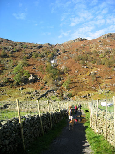
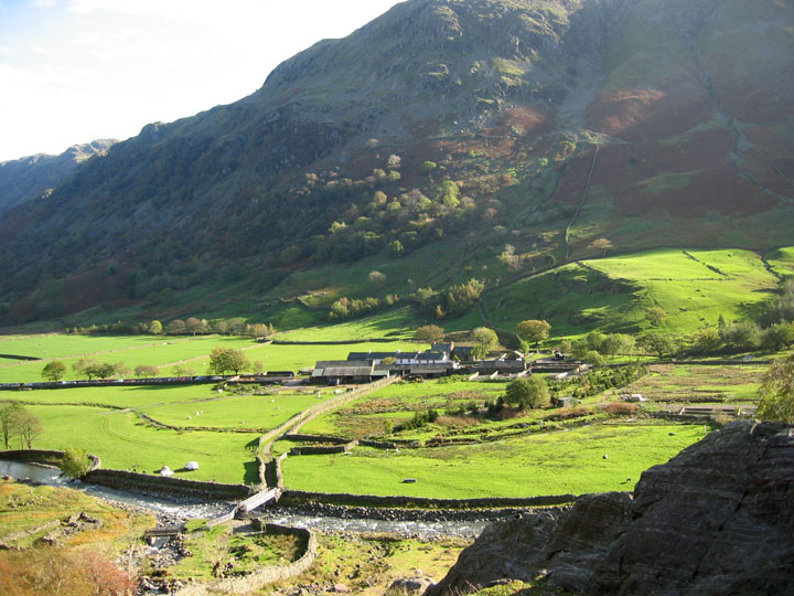
The forecast had been good for today, it was the last day of the local half-term, and we found a roadside parking spot a few hundred yards down the line of cars which started at the top of the road near the farm. Base Brown was our first objective, seen here above the parked cars.
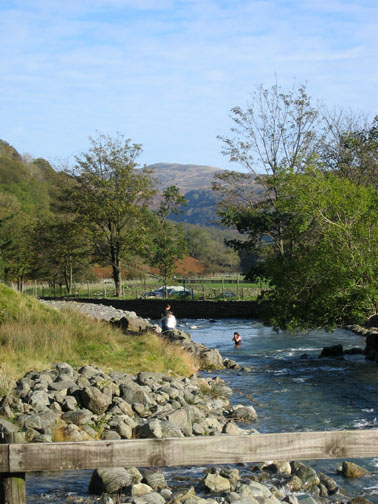
Blue skies, and plenty of water in the river today.
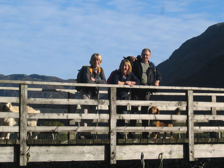
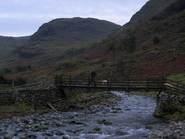
Jo, Ann and John on Seathwaite bridge.
Seathwaite Farm and the Trout hatchery. The young lady is left to her towel, and the bridge is left far below, as we climb up alongside Sour Milk Gill.
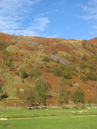
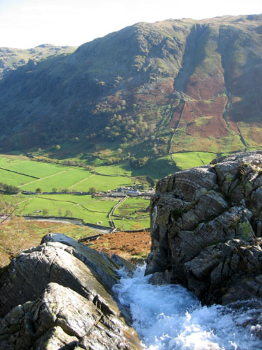
A pause at the top of the rise to appreciate the view over Borrowdale.
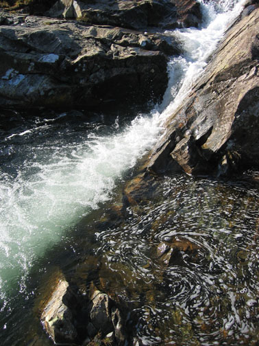
A steady climb up the steep side of Base Brown was made more difficult by the recent weather. The rock scramble as we neared the Perched Boulder was particularly wet and slippery, but with care both ourselves and the dogs negotiated it without too many problems. We had now been climbing about 1700 feet in just over a mile of walking ~ a consistent and steep climb ~ but a real delight.
Across Gillercombe the farmers were gathering sheep again. They look like grains of sand in an egg timer as they followed each other across the fells. The sheep and the farmer's dogs reminded me of a joke I heard recently. As it's a clean joke, maybe I could repeat it here . . .
But I digress . . .
Back to the hills, and we make the summit of Base Brown about an hour and a half after the start of our walk. slower than the Fell and Rock predicted time, but that's not unusual for us. From Base Brown you get that wonderful view of the high fells, from Esk Pike and Bowfell, all the way round to Scafell Pike, Scafell and Lingmell.
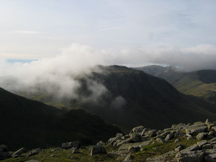
The dark crags of Great Gable, as the mist swirls around the imposing fell side. Great Gable would add the best part of an hour for us if we climbed it today, but as the clocks have just gone back, it will be dark sooner this evening so we decline the opportunity in favour of other fells.
Wild Ennerdale. There is a project on to return this valley to it's natural habitat. There is no public road to Black Sail, and with selective re-planting and habitat control it should improve the potential for the wildlife.
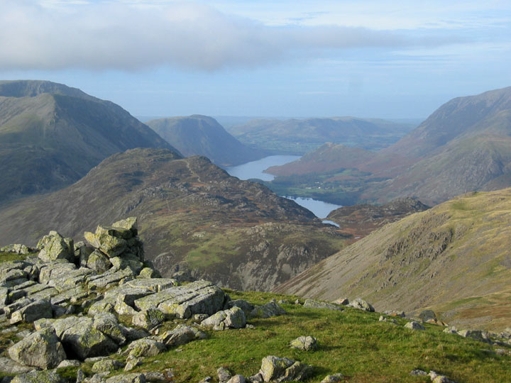
The High Stile Ridge, and the Buttermere Valley beyond Haystacks. ( With apologies to Stephen, who was bending down for his flask of soup at the time.) Great to stop and chat for a short while on such a fine day.
Kirk Fell with a passing cloud. Great view, and a good time to stop for lunch !
A slight breeze made us put on an extra layer of clothing, but was not that bad that we had to seek shelter.
Buttermere again, this time from Green Gable Crags.
However time was getting on and we had four more objectives en route to the end of the walk This was the first, the pools at Gillercombe Head, at the start of the gentle climb to Brandreth.
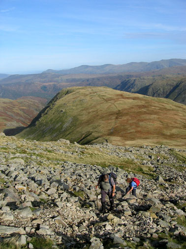
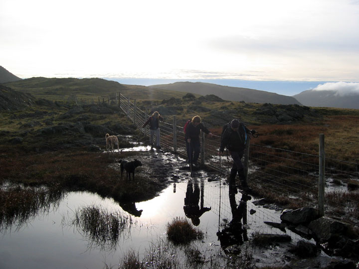
The walk across to Grey Knotts was an easy grass stroll apart from a few rather peat-boggy bits that needed care to cross.
Soft cloud on Pillar from one of the small tarns on Grey Knotts.
Late afternoon sun on the rocky outcrop of Grey Knotts.
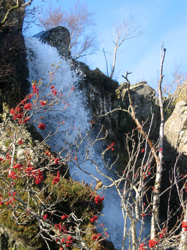
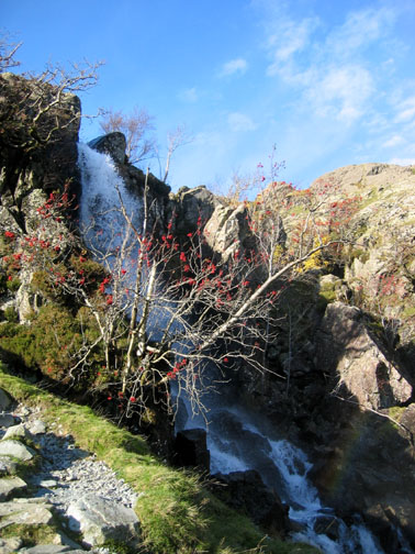
These were important mines in that they produced Plumbago or black lead, a form of graphite, with innumerable historic uses.
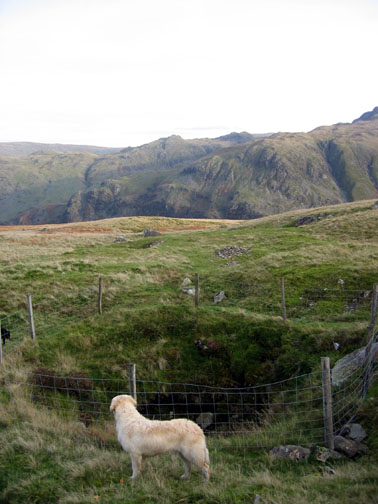
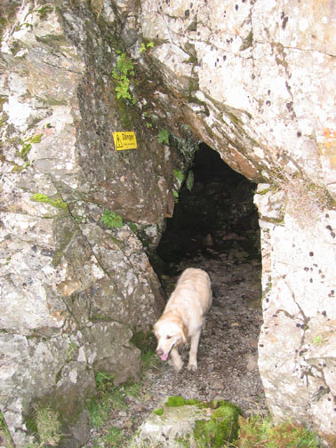
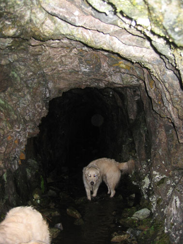
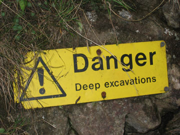
There are many small tunnel openings on the hillside and a sharp eye was necessary to stop the dogs venturing in too far.
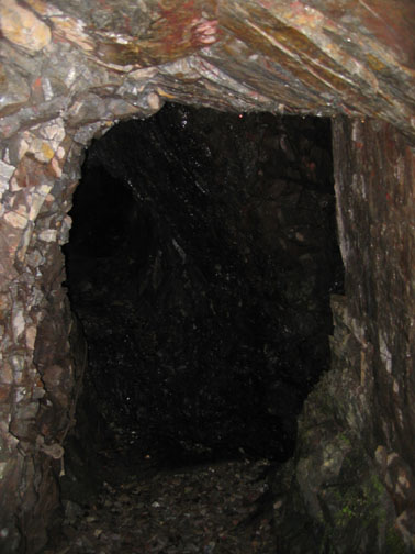
What can be seen here is the horizontal entrance tunnel which continues further forward into the hill. What is not so clear is the 45 degree shaft, just visible on the left hand picture, that crossed the addit and disappeared down to who knows where !
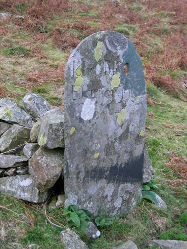
John Banks was a local benefactor, and a second, more modern memorial plaque was seen lower down in the valley.
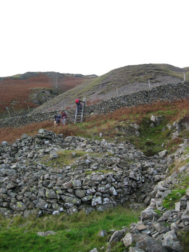
After making tentative investigations of the mines, we followed the old miner's paths down through the lower workings and safely back down to valley level.
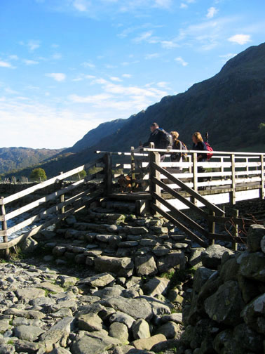
Back to the bridge we used at the start of the day and the end of a fine circular walk above Borrowdale. |
- - - o o o - - - Technical note: Pictures taken with a Canon IXUS 400 Digital camera. Resized in Photoshop, and built up on a Dreamweaver web builder. This site best viewed with . . . Borrowdale lead in your pencil. Go to Top # © RmH # Email me here # Go to 2006 Archive Previous walk - 24th October 2006 Grasmoor and a Birkett Round of local fells Previous time up here - 5th October 2005 Sour Milk Gill and Base Brown - - - o o o - - -
|