![]()
|
|
|
|
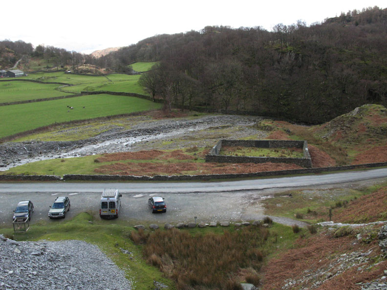
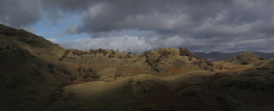
Date & Time: Wednesday 27th February 2008. 11.25 am start. Location of Start : Tilberthwaite Quarries, Cumbria, Uk. ( NY 306 010 ) Places visited : Slate Quarries, Steel Edge, Wetherlam, Wetherlam Edge, Dry Cove Bottom, Tilberthwaite Gill, Low Tilberthwaite Farm and back. Walk details : 4.2 mls, 2200 ft of ascent, 4 hrs 55 mins. Highest point : Wetherlam 2,499ft ( 762m)Walked with : Dave Dimmock, Ann and the dogs, Harry and Bethan. Weather : Cloudy with breaks giving some sunny spells. Windy and cool on top. Two dubious characters at Tilberthwaite Quarries car parking Outside the car . . . Dave and Ann |
|
|
We motored to the South Lakes today to meet up with Dave Dimmock, a friend met through the OFC, who was on holiday in Skelwith Bridge. Our walking route was only decided over one of his cups of tea before the start . . . so Wetherlam from Tilberthwaite it would be.
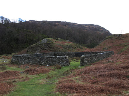
Ample parking for everyone at the Tilberthwaite Quarries. The map shows the square sheepfold in the field, but gives no clues as to it's hidden artistic secrets.
The sheep fold was rebuilt by Andy Goldsworthy and his team of land artists in 2003
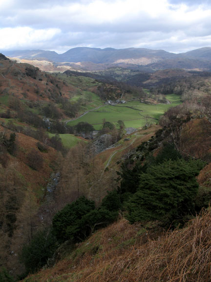
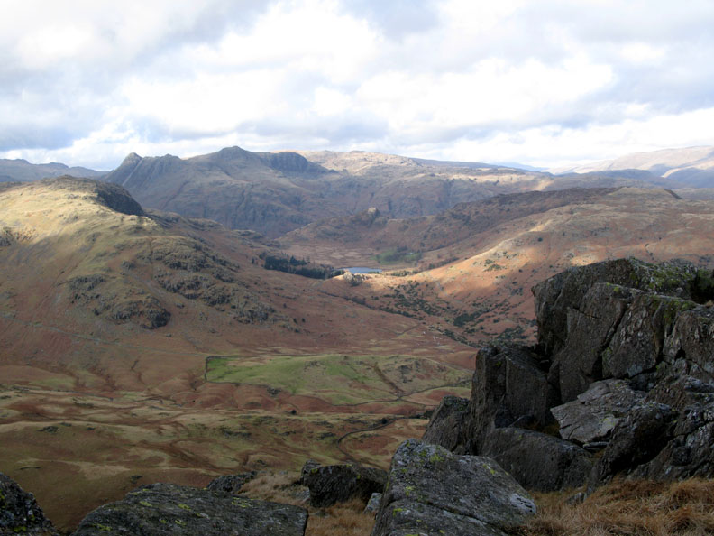
Looking back to the surprisingly green pastures of Low Tilberthwaite below.
Froswick and Ill Bell on the Kentmere Round are the high fells in the distance.
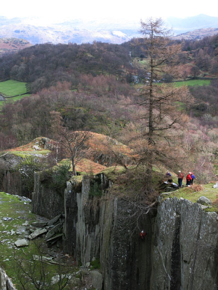
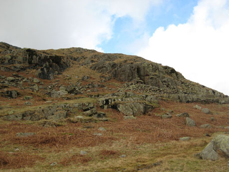
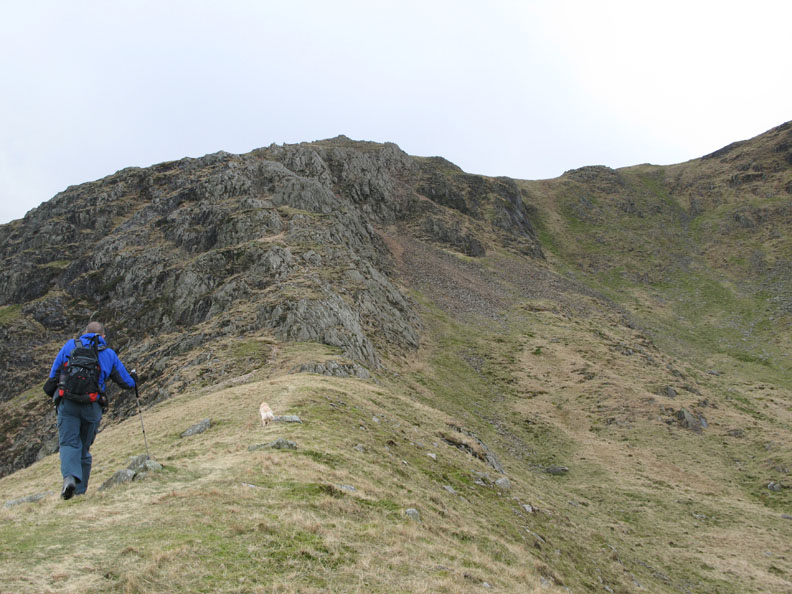
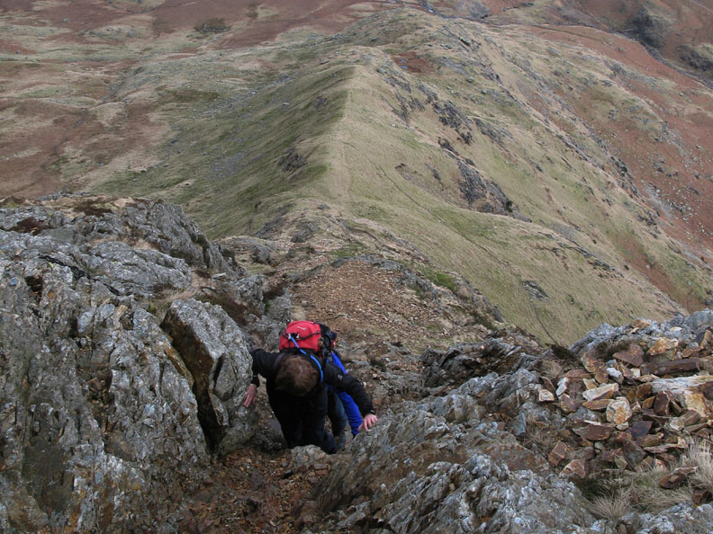
This is Steel Edge. There was no footpath marked so we took a chance on the route. I'm sure I had heard mention that someone had climbed it successfully before.
Dappled sunshine crosses the slopes opposite as we start the climb of Steel Edge.
Zooming in on Helvellyn as we climb above the level of the fell side opposite Just visible is the Howitzer on Helm Crag. It's the rock just right of centre in the shadow.
Looking over Holme Fell and Windermere towards the sunshine and shade on the Howgill Fells
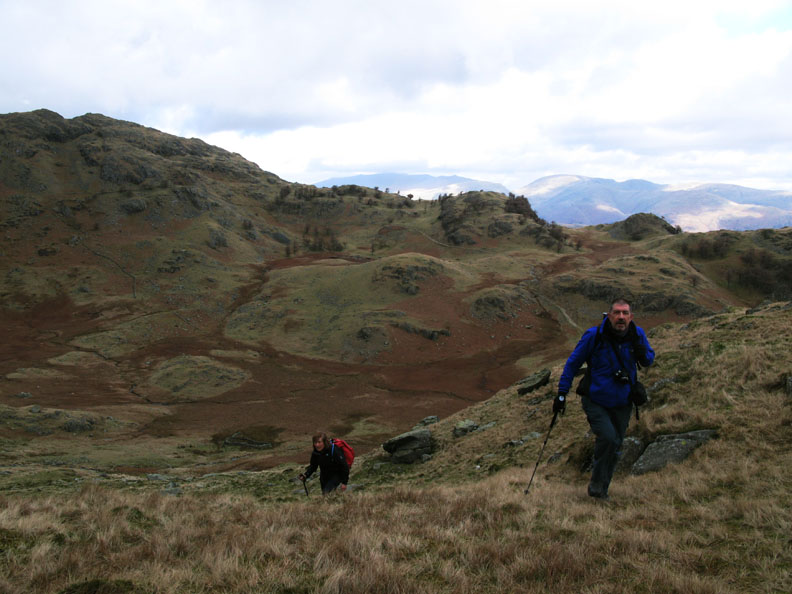
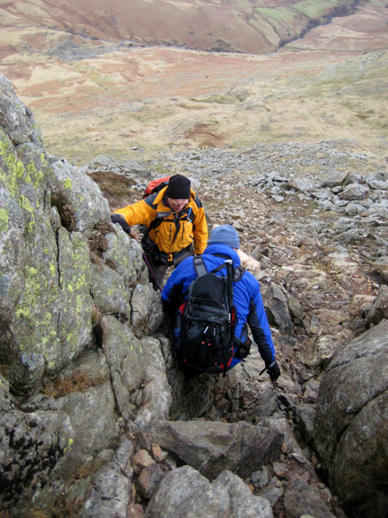
I had thought to climb the grassy section to the side or perhaps the brown scree in the centre but as we climbed a direct ascent became evident.
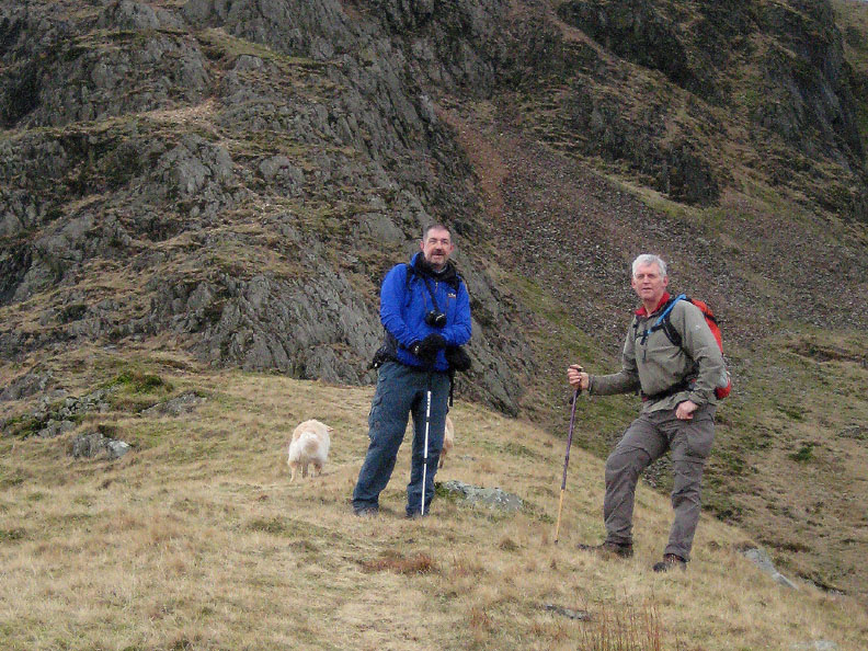
Ann calls for a photo before we leave the grassy ridge and start the rocky scramble up the steep section.
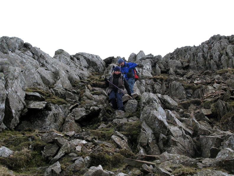
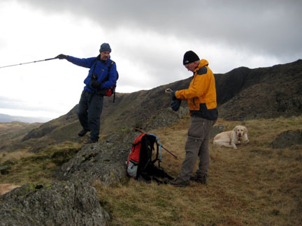
Dave and Ann pack away the trek poles in favour of a hands-on approach.
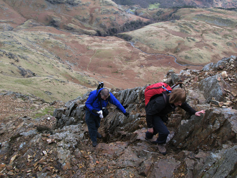
The crux of the scramble - but don't panic - it wasn't too difficult :o)
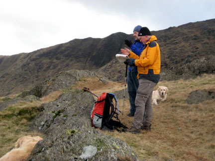
"What took you so long to get up that bit ?"
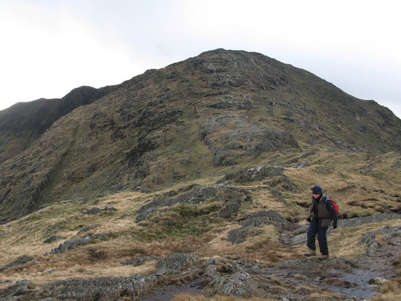
The route led us out onto the less steep section of the main Wetherlam ridge, soon joining the main path which has climbed from Coniston Valley.
Opposite and to our west, the top of the Old Man is covered in cloud.
Similarly the top of Brim Fell is also obscured today.
However we are cloud free as we make our way to the summit of Wetherlam, a short distance ahead.
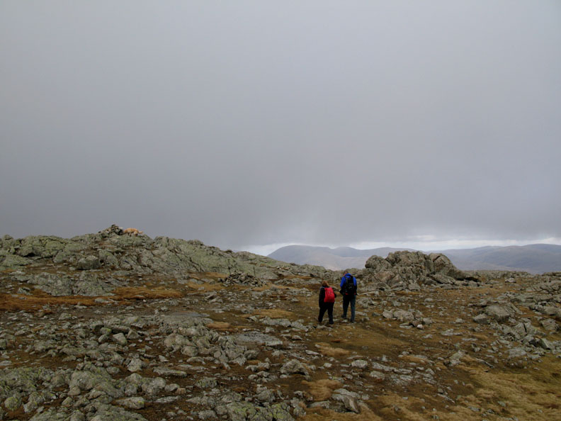
Touch and go with the views due to the low cloud. We can see Pike O 'Stickle but not Great Gable somewhere above the top stone of the cairn.
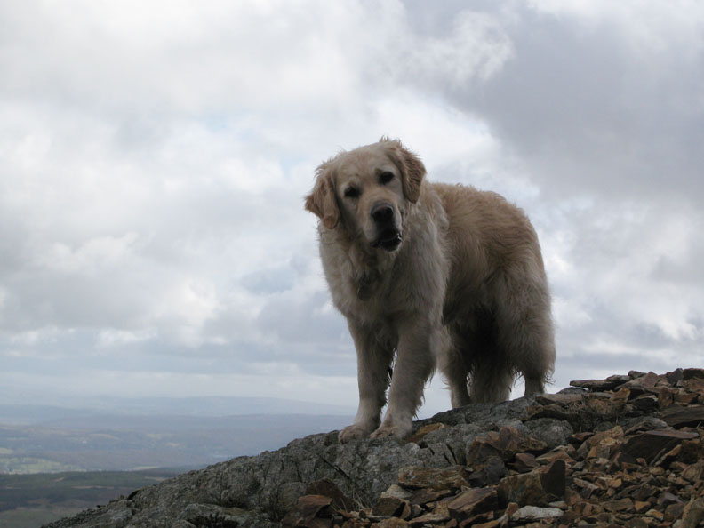
The dogs enjoy the cool breeze as gaps in the cloud gives Blea Tarn a patch of sunshine.
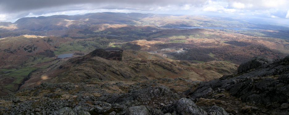
Whilst enjoying lunch (in the shelter of the top crags) we were able to look around and enjoy the scenery. This is the panorama of Cold Pike, Crinkle Crags, and Bowfell with Pike O 'Blisco enjoying a sunny period.
Good sun now on the Langdale Pikes.
Side Pike almost in 3D with Pavey Ark, Stickle Tarn and the Blea Rigg fells in the shadow behind.
Ahead of us Yew Tree Farm in the valley and Tarn Hows just showing in the trees above.
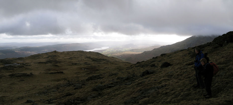
Ahead, a panoramic view from Dunmail Rise across the full length of the southern slopes of Lakeland. The drop down to Birk Fell below was hidden by the ever steepening crags. This was the start of Wetherlam Edge. New territory for us - it shows a footpath on the map and we've heard it's a good route - just follow the rocky path and the cairns.
Wetherlam Edge turns out to be quite steep, quite rocky and quite loose !
The steepest part over now but the path is still loose and stoney.
Ann safely down to the grassy ridge below.
We continued along the ridge till we reached Birk Fell, from where I took this photo of Blea Tarn and the Pikes. The path from here down was less distinct, even the 1:25k map was not terribly helpful.
We rejoin the path after leaving the summit and find ourselves descending past the first of many old copper mines.
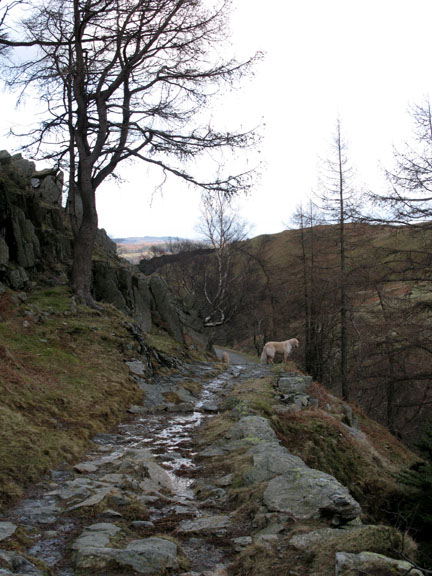
A modern pitched path makes it's way down amongst the numerous stumps of an old pine grove. The wood has presumably been used for pit props or firewood by the early miners.
The path led down to another old mine, from where we took the track round the fell side and down towards Tilberthwaite again.
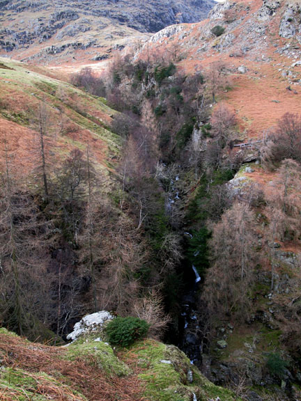
Dry Cove Bottom, so called because there is no longer a tarn in the round headed, upland valley.
The stream, however, flows strongly over the small waterfall and down past yet more old copper workings.
Nearing the end of the walk we drop down the hillside, opposite the slate quarries we passed on our ascent earlier in the day. We are now down to the same height as Holme Fell and the car is within sight.
A bold Herdwick sheep holds it's ground as we pass along the track within a few feet of him. It's not bothered by us or the dogs. It's seen the likes of us before no doubt.
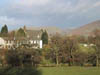
The cottages at Low Tilberthwaite including this one with a rather fine old gallery. Plenty of firewood cut below, and cane chairs to relax on above, after a hard mornings work perhaps.
It was just a short walk back to the cars at the end of a really great walk. The route was new to us even though we had climbed Wetherlam several times. The quarries and mines were interesting, and the scenery was rocky and quite varied. All together it added up to an extremely good walk and one that we might repeat in the not too distant future.
|
- - - o o o - - - Technical note: Pictures taken with my Canon G7 or Ann's Ixus Digital cameras. Resized in Photoshop, and built up on a Dreamweaver web builder. This site best viewed with . . . a lack of planning for a change. © RmH.2007 # Email me here # Guest book (on the front page) Previous walk - 25th Feb 2008 Mellbreak with Sean A previous time up here - 3rd October 2006 The Wetherlam - Dow Crags Round
|