|
|
|
 |
Remember: Press F11 for a
full screen view of this page. |
Web Counter when published 2
069 870 |
|
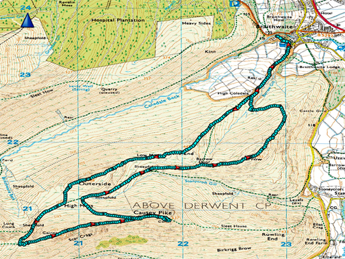
" Causey Pike with the Mob " Date & start time: 11th March 2023. 10 am start. (feels like 9am as clocks changed last night). Location of Start : Adj to The Orthodox Church, Braithwaite, Cumbria, Uk. ( NY 229 236). Places visited : Stile End, Outerside, Scar Crags, Causey Pike, Barrow Door, Barrow. Walk details : 7.4 miles, 2675 ft of ascent, 5 hours. Highest point : Causey Pike, 2,089ft - 637m. Walked with : Chris, Pip, Catrina, Richard, Peter and myself, plus Dylan and Dougal. Weather : Overcast, occasional sun, damp in the air at times. Cool. |
© Crown copyright. All rights reserved. Licence number PU 100034184. |
|
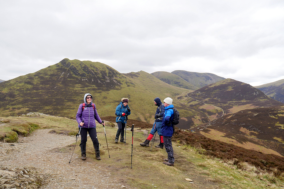
It seemed like an early start for the six of us as the clocks went forward last night and we've lost an hours sleep. That didn't stop us getting up and out for this Mockerkin Mob walk up Causey Pike, led by Chris and Pip.
A cheerful first photo except for myself, as I was wondering if the camera would stay balanced on the bonnet of the car !
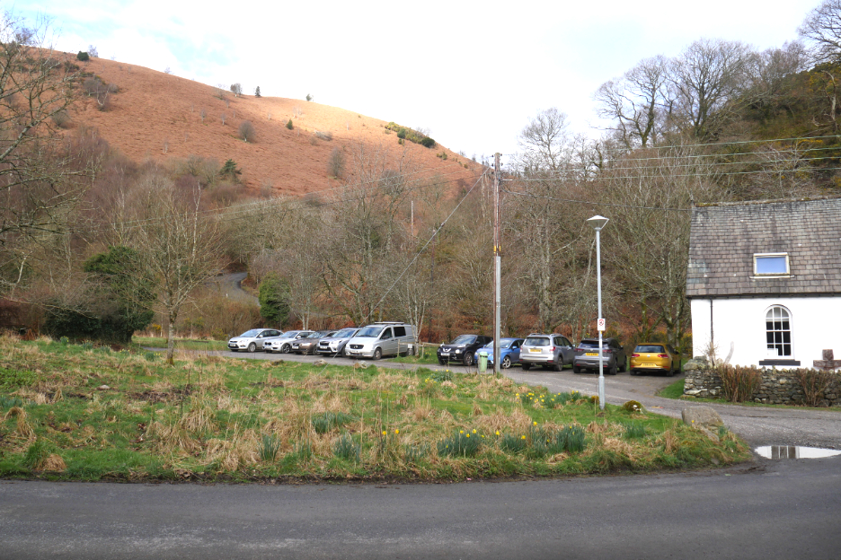
Free parking was found next to the Church at Braithwaite.
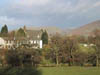
The Coledale Inn which we passed on the way out and which would also feature on our return leg.
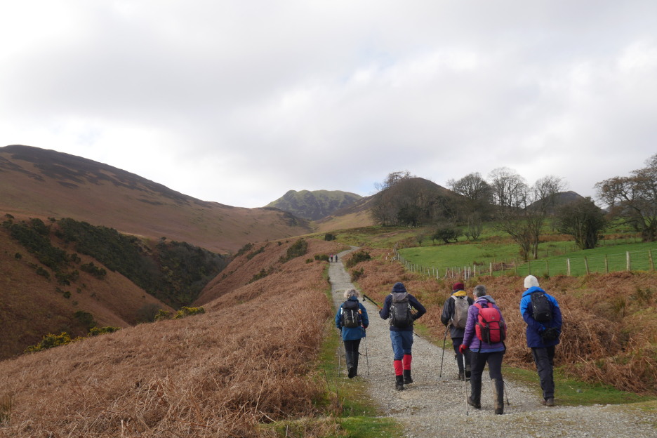
Heading out on the track to the old abandoned farm at High Coledale.
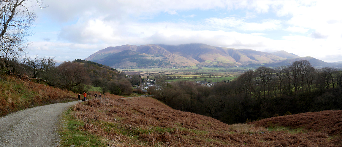
Comments were made about the lovely view north to Bassenthwaite as it showed itself briefly between Kinn and Braithwaite How.
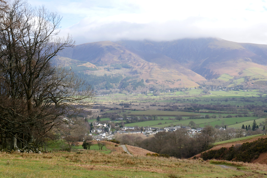
Early sunshine brightens the view across to Skiddaw and Blencathra but the summit of both were still catching the clouds today.
The track is in good condition as it also leads to a service reservoir for drinking water for the village.
Zooming in as we climb steadily higher. The houses of Braithwaite and the many caravans and campers in the centre of the village campsite now come into view.
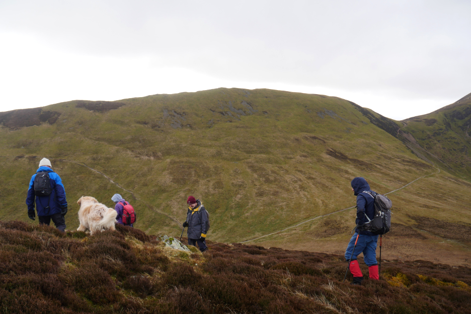
Our route today climbs Stile End so we leave the path to Barrow Door and head up the adjacent steeper slope. Barrow is on the left and Causey Pike on the right, but what's the pointed one in the middle ? It's the start of the ridge up to Maiden Moor and High Spy . . . so it's the famous Catbells.
The view on the opposite side is an extensive one, across the Coledale Valley to Grisedale Pike on the opposite side. The track to Coledale Mine can just be seen running along its lower flanks.
The flat top of Stile End is known as Low Moss. The damp conditions on "the moss" led to several collections of frogs spawn being found. Several of the clumps had white patches and we wondered if this was due to ice, seeing it's been so cold overnight recently.
The "Three Musketeers" or is it a scene from "Last of the Summer Wine" ? Something in the direction of Causey Pike, across the Stonycroft Gill Valley, has caught Richard's eye.
The climb continues onto our first real summit, that of Outerside. From here we can look down properly at the old Force Crag Mine. It started as a lead mine but went on to produced zinc and Barytes (barium). It closed in the 1990's after a roof collapse and so ended the commercial life of the last mineral mine in The Lake District. The mine buildings have been partially restored and the mine is now under the protection of the National Trust.
Outerside means we have climbed the first of four Wainwright tops of the day. Click here or on the photo above for a 360 degree annotated panorama.
Time for elevenses to celebrate the fact . . . once we've found a spot with enough flat and dry space for six. We indulged in a drink and rather nice flapjack from Pip . . . thanks. Looking across, our upward track climbs to the right and our return footpath down from Causey descends via the path on the left.
The briefest of stops on the hause between Sale and Scar Crags, where we get a view across to Buttermere's High Stile Ridge. The broad paths here are as a result of the Fix-the-Fells digger being a bit enthusiastic all those years ago.
The rather unnatural footpath has still not blended in and it's been years now since it was first done. [ You can check out the rest of ther 2009 walk later on at the base of this page ]
We turn left and take the 'high road' over Scar Crags as other fell walkers coming the other way prefer the lower path.
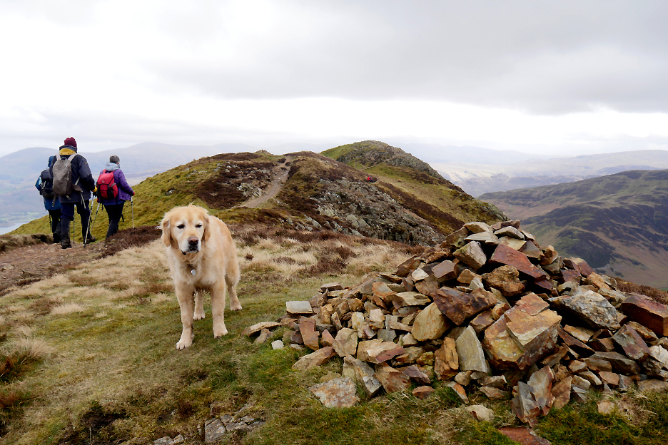
Several of Causey Pike's bumps have large cairns on their tops.
However the true summit is more or less devoid of such man-made focal points. Still we've made it and we stop for a group photo even though the breeze was a little cool.
A big thanks to these guys for taking our photo. The young lad has done well today as he's due a cartilage op shortly (due to a rugby injury). I hope it goes okay.
On our return we stopped in the shelter of one of the 'bumps' for a spot of lunch. The wind on our backs has been blowing down from the arctic, reaching us from a north easterly direction. One of the discussions of the moment was whether the few flakes passing overhead constituted snow at lunchtime !
Whatever it was it didn't settle here or on Ard Crags opposite. Instead we sat, ate and played the Lake District Game . . . name all the fells you can see left to right. They include the Langdale Pikes, Glaramara, Bowfell, Gable, the Scafells and round to Pillar on the right. Between them and us are the four summits of Ard Crags, Robinson, Hindscarth and Dale Head.
On undulating fell walks, often the beauty is in the occasional glimpses of fells or lakes through suddenly opening gaps. Our next summit of Barrow was highlighted in such a way .
Suitably refreshed we head back along the ridge, but this time we head down to the right before the ascent of Scar Crags. We're aiming for that obvious path to the right, which is the top of the Stonycroft Miner's Track.
We reach the Miner's Track and comment that it is unusually devoid of any sign of mines in this part of the valley. There is one lower down Stonycroft Gill but no evidence of one up here. Perhaps it's name comes from the secondary purpose of giving local miners access to Force Crag Mine from their homes in the Newlands Valley.
Scar Crags and Sail to the left and Outerside behind us, as we climb gently up from Barrow Door towards Barrow itself.
Standing around and talking again . . . but hold on . . . that's allowed at a summit.
We reach the top of our fourth Wainwright of the day and take a suitable photo. keen observers may notice a gradual change in the weather as showers have crossed from the Skiddaw direction and now re-form over Helvellyn.
It's downhill all the way now, with views ahead of Keswick and Derwent Water.
Looking over the edge we can see Uzzicar Farm below us. This was the site of the important Barrow Mine which was dug close to the road, in the square field to the right of the farm buildings. Evidence of the spoil heaps litter the roadside and can be identified by the poor vegetation, following pollution by the lead waste.
From the nick at the old mine workings half way down the fell, we branch off to the left and our sights now change to the Barrow Gill valley below and north over Braithwaite to Bassenthwaite Lake.
The green path leads us gently down to the top part of the small ravine carrying Barrow Gill.
The path crosses the stream just before it starts its cascading descent towards the village.
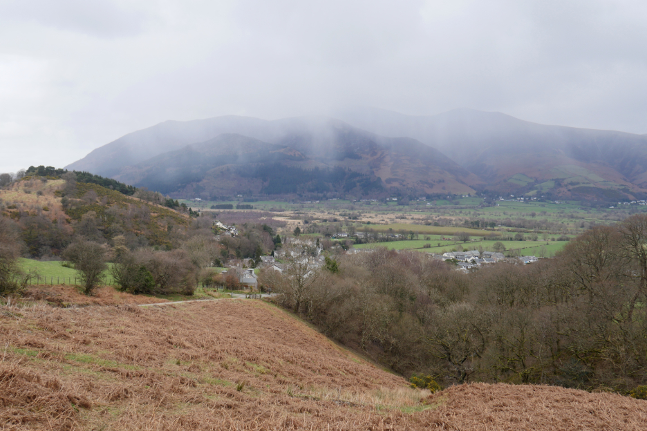
Cooler and more threatening weather as we near the end of the walk.
It didn't actually rain on us so we'll put the visit down as a very sociable experience at the end of the walk. Pass the crisps ! - - - o o o - - - |


Technical note: Pictures taken with my Panasonic Lumix Gx8 Camera.
Resized in Photoshop, and built up on a Dreamweaver web builder.
This site best viewed with . . . a vegetarian version of Black Pudding crisps (chips to my American viewers)
Go to Home Page . . . © RmH . . . Email me here
Previous walk - 25th March 2023 - An Afternoon Buttermere
A previous time up here - Sunday 14th June 2009 Causey Pike from Stoneycroft
Next event - 1st April 2023 - The arrival of The Bond Team